April 15, 1999 - Grand Canyon - 9 Days
New Hance, Escalante, Tonto and Grandview Trail
<Click on the thumbnail images to enlarge the pictures>
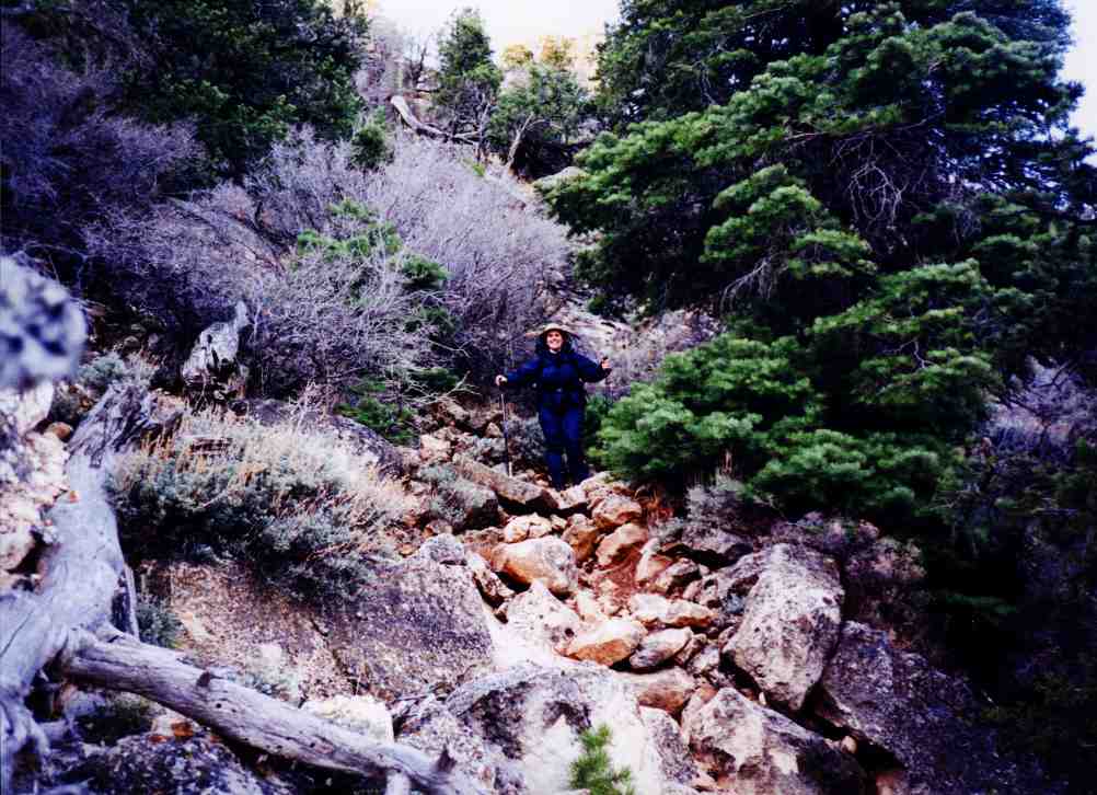
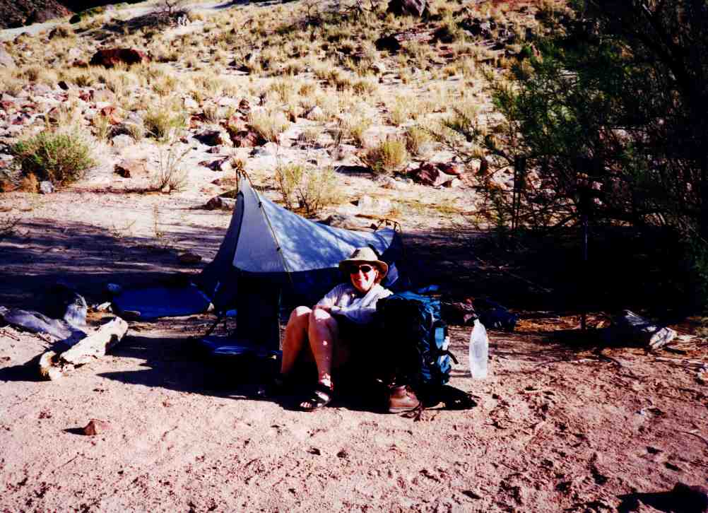
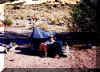
Day 0 (Wednesday) - Kathy is standing at the New Hance trailhead
contemplating our trip starting the 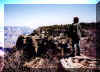 following
day, and surveying our home for the next week and a half. The weather is looking
great, although a little cooler than we are used to at the Canyon. After
scouting the first few hundred feet of the trail, we headed East to Cameron
Trading Post for one of their great Navajo style breakfasts. following
day, and surveying our home for the next week and a half. The weather is looking
great, although a little cooler than we are used to at the Canyon. After
scouting the first few hundred feet of the trail, we headed East to Cameron
Trading Post for one of their great Navajo style breakfasts.
Day 1 (Thursday) brings more nice weather. We had stayed at the Yavapai Lodge at the
South Rim with plans of being at the Trailhead for sunrise. Our plans were
complicated when a local construction project caused a planned power outage from
10PM to 5AM. So much for alarm clocks and lights to pack our gear. We adapted,
however, and were at the trailhead on schedule.
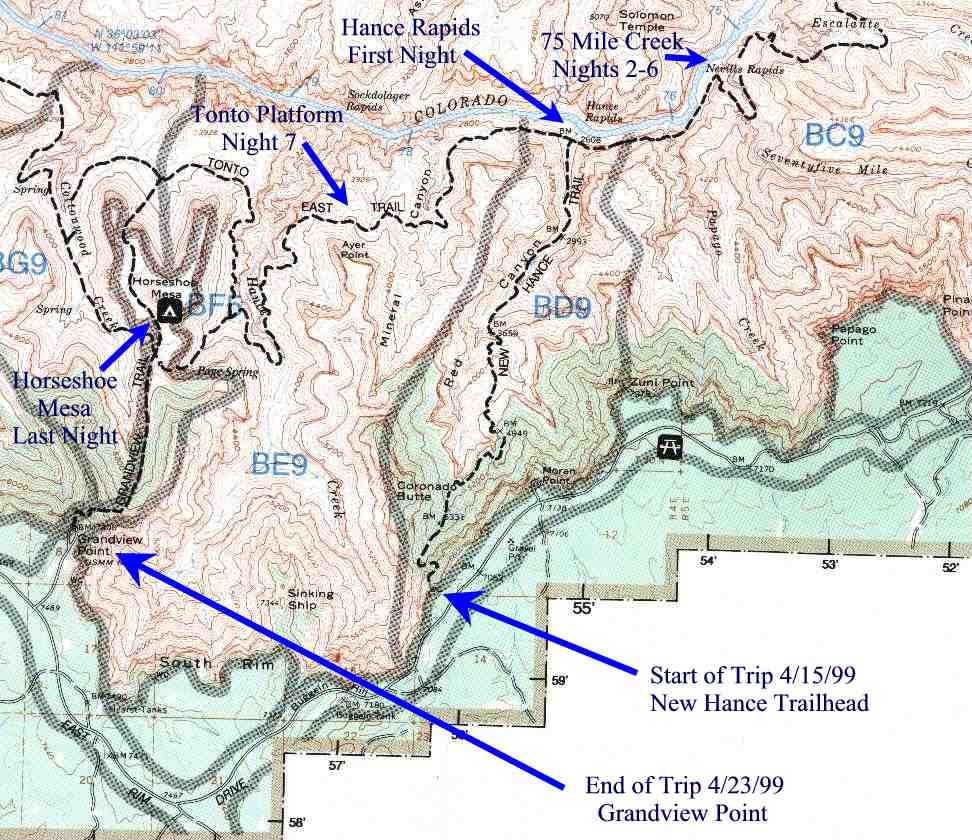
 The
upper part of the new Hance is quite steep and rocky, but presented no real
challenges other than requiring a bit of care. Kathy and I were pretty excited, as we
always are starting another Grand Canyon adventure. The weather was around 30
degrees, but we had no problems with ice on the trail. The wind made it feel
colder. The
upper part of the new Hance is quite steep and rocky, but presented no real
challenges other than requiring a bit of care. Kathy and I were pretty excited, as we
always are starting another Grand Canyon adventure. The weather was around 30
degrees, but we had no problems with ice on the trail. The wind made it feel
colder.
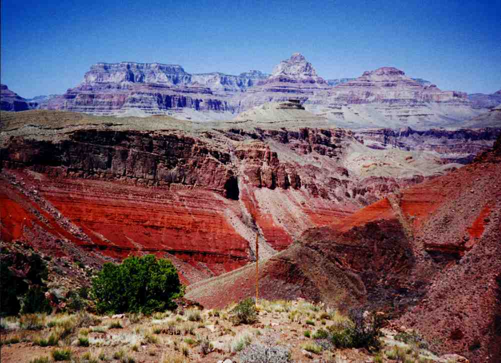
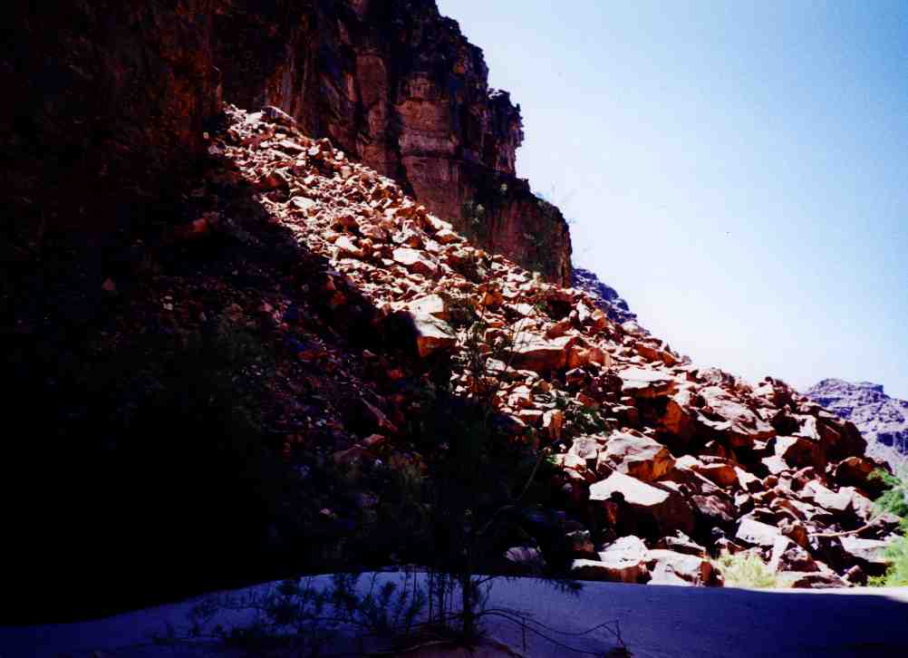
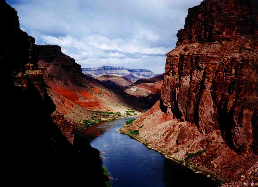
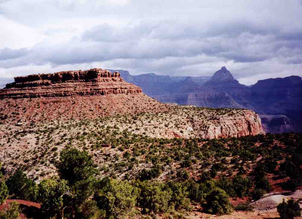
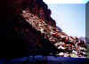
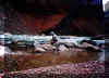
 We
were below the redwall by 11:30 and took a leisurely lunch at a level clearing
with a great view that would make an excellent campsite. There are decent
campsites both above and below the redwall on this trail. The picture shows why
they call this Red Canyon. We
were below the redwall by 11:30 and took a leisurely lunch at a level clearing
with a great view that would make an excellent campsite. There are decent
campsites both above and below the redwall on this trail. The picture shows why
they call this Red Canyon.
 We
arrived at Hance Rapids in mid-afternoon. The trail below the redwall is not
challenging, except for crossing some boulder strewn slide areas. There is no
view of the Colorado River at all on this trail until you round the last bend a
few hundred yards away. We found that a bit disappointing. We set up camp near
the beach at the bottom of the rapids. We
arrived at Hance Rapids in mid-afternoon. The trail below the redwall is not
challenging, except for crossing some boulder strewn slide areas. There is no
view of the Colorado River at all on this trail until you round the last bend a
few hundred yards away. We found that a bit disappointing. We set up camp near
the beach at the bottom of the rapids.
Day 2 (Friday) started with a breakfast of eggs and hash browns with
peppers and bacon bits. A rafting trip that had been camped just up river ran
the rapids around 9:30. That brought back memories of a few years earlier when
Kathy and I took our rafting trip with OARS
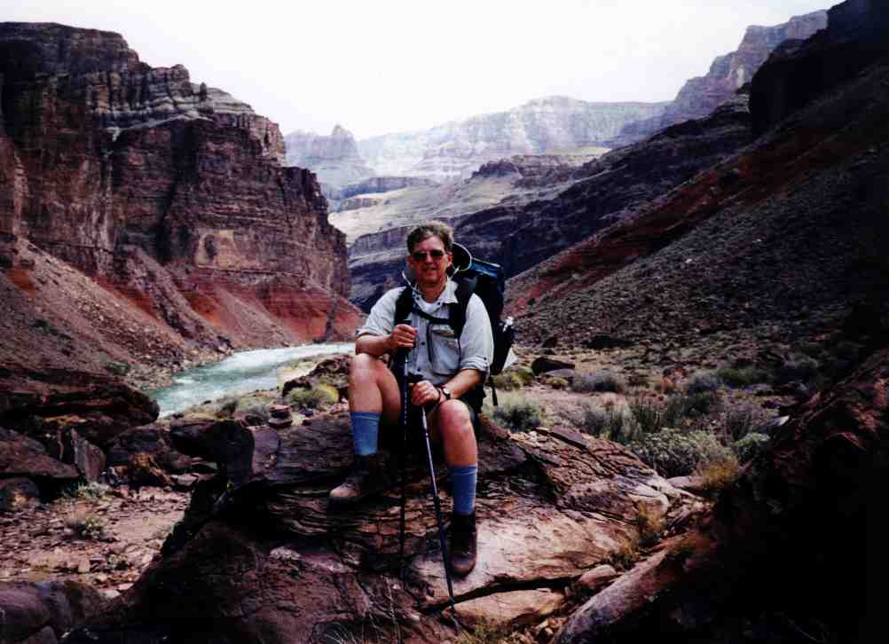
through those same rapids. After a light lunch, we hit the trail at 11:30 for 75
Mile Creek, our home for the next five days.
 Around
Papago Creek, we came upon a large slide area blocking our way. We climbed the
upstream side (not the best route as we found out later) and scrambled over the
loose rocks, being careful not to trigger a new slide or send rocks careening
down onto each other. Around
Papago Creek, we came upon a large slide area blocking our way. We climbed the
upstream side (not the best route as we found out later) and scrambled over the
loose rocks, being careful not to trigger a new slide or send rocks careening
down onto each other.
 Eventually,
we reached the top where we stopped for a few minutes and enjoyed the nice view
overlooking the route back toward Hance Rapids. We were not looking forward to
climbing back down, that we knew we would have to do later that week. Continuing
on, we encountered the only area on our trip where we had to remove our packs
and lower them on ropes as we went back down to river level. Eventually,
we reached the top where we stopped for a few minutes and enjoyed the nice view
overlooking the route back toward Hance Rapids. We were not looking forward to
climbing back down, that we knew we would have to do later that week. Continuing
on, we encountered the only area on our trip where we had to remove our packs
and lower them on ropes as we went back down to river level.
 After
Papago, it is an easy walk along the shore to the beach at 75 Mile Creek. We did
have one false start when we started climbing high around an outcropping just
short of 75 Mile, but after ascending about 100 feet, we noticed another hiker
walking along the ledges at river level. We descended again and followed the
ledges without much difficulty. We found a great 200 foot stretch of crescent
beach with an excellent campsite where we made our home for the next five
nights. After
Papago, it is an easy walk along the shore to the beach at 75 Mile Creek. We did
have one false start when we started climbing high around an outcropping just
short of 75 Mile, but after ascending about 100 feet, we noticed another hiker
walking along the ledges at river level. We descended again and followed the
ledges without much difficulty. We found a great 200 foot stretch of crescent
beach with an excellent campsite where we made our home for the next five
nights.
Day 3 (Saturday) found more nice weather. We watched some rafts go by,
and took a short hike up 75 Mile Creek. The first half mile or so is a very
impressive high walled, narrow slot canyon that eventually opens up with
views to Desert View tower. We had our sandals on so we turned back after a
short while, planning to come back the next day better equipped for hiking.
After lunch, we were visited in camp by a man we had seen the previous day
camping at Hance Rapids. He was hiking over to Escalante Creek, just a short
distance up river. Coincidentally, he was originally from Portsmouth, Rhode
Island, just a few miles from our home. He now resides in Flagstaff.
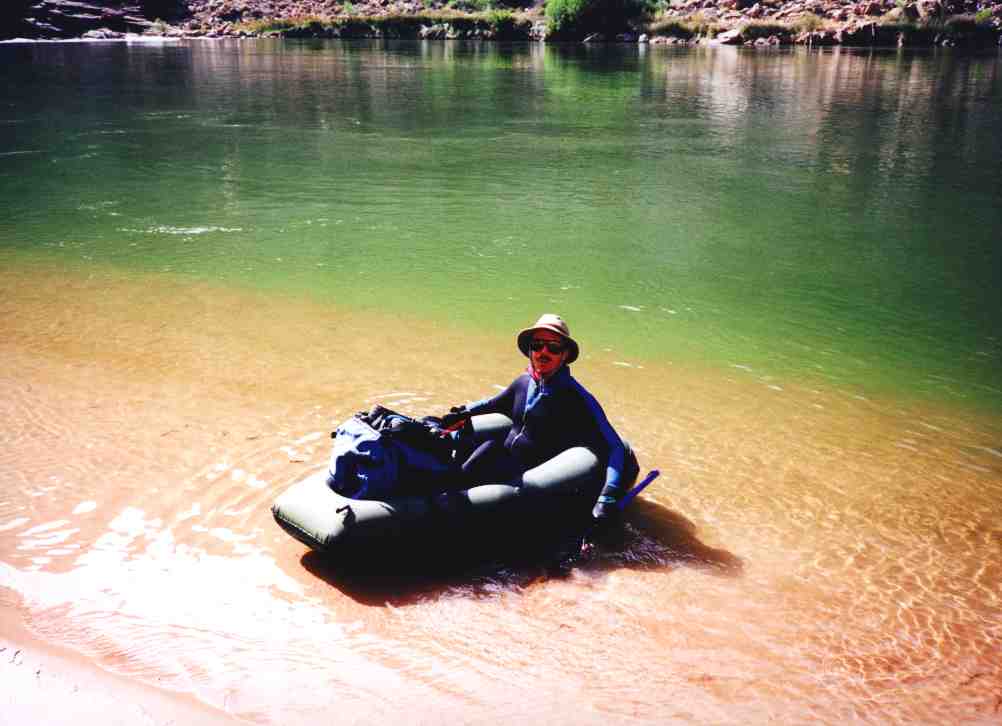
Although the river distance is short, there is a large outcropping between 75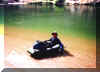 mile and Escalante requiring a lengthy hike to climb up and over. He had the
foresight, however, to bring a one man raft along with him, and an hour or so
later he came floating down the river. We were so impressed with the raft,
weighing a mere 3.5 pounds including paddles, that we bought two from Campmor
when we returned home. That evening, we watched eagles soaring over the distant
cliffs, and hit the sleeping bags at sunset.
mile and Escalante requiring a lengthy hike to climb up and over. He had the
foresight, however, to bring a one man raft along with him, and an hour or so
later he came floating down the river. We were so impressed with the raft,
weighing a mere 3.5 pounds including paddles, that we bought two from Campmor
when we returned home. That evening, we watched eagles soaring over the distant
cliffs, and hit the sleeping bags at sunset.
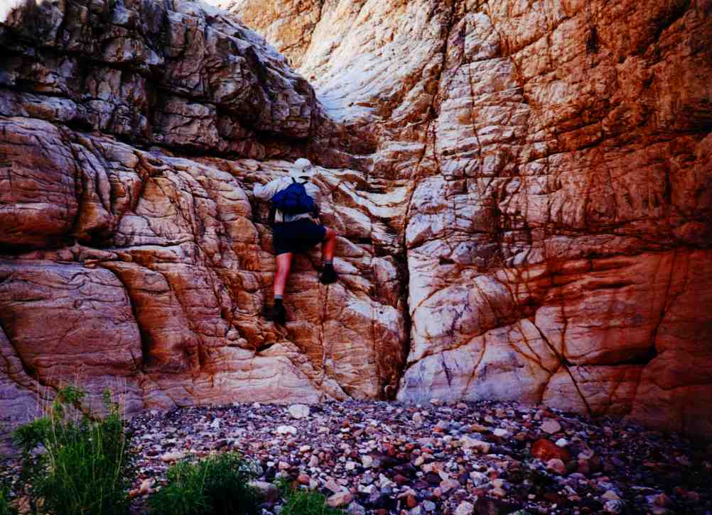
Day 4 (Sunday) was another great weather day with temperatures in the
eighties, just like the 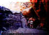 others.
We packed a lunch and at 9:15 started up 75 Mile Creek again. There are several pour offs
that had to be climbed around, and more that we could scramble up. At noon, we
stopped for lunch with a nice view of the 75 Mile Saddle on Tanner Trail and
Lipan Point. After 45 minutes resting and enjoying the view, we headed back down
to camp. Climbing down one of the pour offs, searching for toe and hand holds, I
was startled to grab a others.
We packed a lunch and at 9:15 started up 75 Mile Creek again. There are several pour offs
that had to be climbed around, and more that we could scramble up. At noon, we
stopped for lunch with a nice view of the 75 Mile Saddle on Tanner Trail and
Lipan Point. After 45 minutes resting and enjoying the view, we headed back down
to camp. Climbing down one of the pour offs, searching for toe and hand holds, I
was startled to grab a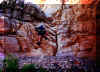 frog living in a damp crack in the rocks. He was not
about to give up his cool, damp home and refused to move. Like other wildlife in
the Canyon, they seem to show no fear of man. After returning to camp at 3PM, we
set up an awning on the beach and watched the river go by. Stayed up to watch
the stars and the moon for a bit, and went to bed around 8:30. frog living in a damp crack in the rocks. He was not
about to give up his cool, damp home and refused to move. Like other wildlife in
the Canyon, they seem to show no fear of man. After returning to camp at 3PM, we
set up an awning on the beach and watched the river go by. Stayed up to watch
the stars and the moon for a bit, and went to bed around 8:30.
 Day
5 (Monday) started as usual with cooking breakfast. As we were just about to
eat our fried eggs and hash browns (again with peppers and bacon bits), we saw a
party of yellow OARS rafts coming down the river. I called out to see if our
friend, Robby, was on the trip and, to our surprise, found that he was leading
this particular trip and answered back to us. He came over and gave us both big hugs. We shortly had a beach full of
rafts and kayaks Day
5 (Monday) started as usual with cooking breakfast. As we were just about to
eat our fried eggs and hash browns (again with peppers and bacon bits), we saw a
party of yellow OARS rafts coming down the river. I called out to see if our
friend, Robby, was on the trip and, to our surprise, found that he was leading
this particular trip and answered back to us. He came over and gave us both big hugs. We shortly had a beach full of
rafts and kayaks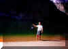 parked waiting for their leader. As a parting gift, Robby gave us a couple of
cold Buds which we kept in our refrigerator (the Colorado River) until we were
ready to drink them that evening. At five pounds a six pack, beer is a scarce
and much sought
after commodity at the bottom of the Grand Canyon. Robby, thank you!!!!
parked waiting for their leader. As a parting gift, Robby gave us a couple of
cold Buds which we kept in our refrigerator (the Colorado River) until we were
ready to drink them that evening. At five pounds a six pack, beer is a scarce
and much sought
after commodity at the bottom of the Grand Canyon. Robby, thank you!!!!
Monday was a busy day for river traffic. After Robby's group, there was a
flotilla of wooden dories, a couple of large motorized rafts, and a small private
party. That afternoon, we were fascinated when a peregrine falcon attempted to
catch a white throated swift. For about 15 minutes, the poor little swift flew
wildly back and forth across the river and over our campsite as the falcon would
go into a series of high speed dives, attempting to stun the bird out of the
sky. Each time, at the last possible moment, the swift would change direction
and avert death. The falcon finally gave up, and the swift retreated to the
safety of the cliffs. One more private rafting party and a larger group of
archaeologists came by just before dark. The private group of three rafts was
lead by a grizzled veteran of 34 years of river running. We chatted for a while
before he finally headed downstream to camp below Nevills Rapids. Monday was a
warm night, and we did not need to zip our sleeping bags.
Day 6 (Tuesday) was another fine day. We started the day off with a
hike high above Papago Creek. From that vantage point, we saw the last two river
trips from the day before camped along the river. We watched them leave and
headed back to 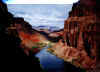 camp. Around noontime, the wind started picking up. It tore down
the awning we had set up on the beach, and started blowing sand. We put the rain
fly on the tent, but the sand still got into everything. This is not unusual for
the Canyon, where the wind can blow at near hurricane force due to the wide
thermal variations between the rim and the river. The winds died down later in
the afternoon, and we took a short hike into the slot canyon to escape the
midday heat. Spent the evening sitting on the beach contemplating our hike
toward Horseshoe Mesa starting the next morning. We watched the bats chasing
insects at dusk. One brazen bat buzzed us and we hit the deck. camp. Around noontime, the wind started picking up. It tore down
the awning we had set up on the beach, and started blowing sand. We put the rain
fly on the tent, but the sand still got into everything. This is not unusual for
the Canyon, where the wind can blow at near hurricane force due to the wide
thermal variations between the rim and the river. The winds died down later in
the afternoon, and we took a short hike into the slot canyon to escape the
midday heat. Spent the evening sitting on the beach contemplating our hike
toward Horseshoe Mesa starting the next morning. We watched the bats chasing
insects at dusk. One brazen bat buzzed us and we hit the deck.
 Day
7 (Wednesday) started with a brief one minute shower around 5AM. We made
some coffee, broke camp, and were on the trail by 6:15. There was some trouble
finding our way up the cliffs at Papago Creek to get above the slide, but we
finally found a suitable route. The slide was much easier going down on the
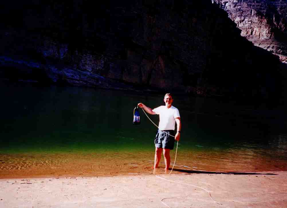
downstream side. Reached Hance Rapids at 8:50 where we had more coffee and
breakfast, and pumped 12 Day
7 (Wednesday) started with a brief one minute shower around 5AM. We made
some coffee, broke camp, and were on the trail by 6:15. There was some trouble
finding our way up the cliffs at Papago Creek to get above the slide, but we
finally found a suitable route. The slide was much easier going down on the
downstream side. Reached Hance Rapids at 8:50 where we had more coffee and
breakfast, and pumped 12  liters of water for the higher and dry trail ahead. We
would have two dry nights on the trail before we would reach the rim. liters of water for the higher and dry trail ahead. We
would have two dry nights on the trail before we would reach the rim.
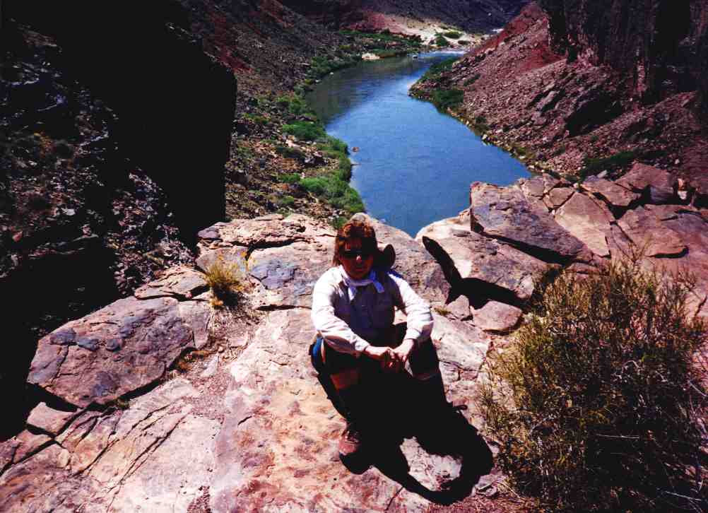
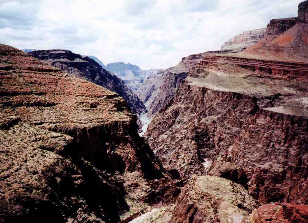
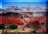
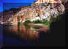
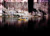
We
set off on the Tonto Trail shortly after 11. It is a long but easy hike to the
bottom of Horseshoe Mesa past Mineral Canyon. We had a brief glimpse of
Sockdolager Rapids (see picture) looking down at Granite 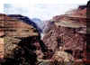 Gorge. There are some
very interesting rock formations along the trail, and a good view of the mines
across the river high on the side of Asbestos Canyon. We reached our camping
area just below Ayer Point at 3:10 in the afternoon.
The wind had increased to Gorge. There are some
very interesting rock formations along the trail, and a good view of the mines
across the river high on the side of Asbestos Canyon. We reached our camping
area just below Ayer Point at 3:10 in the afternoon.
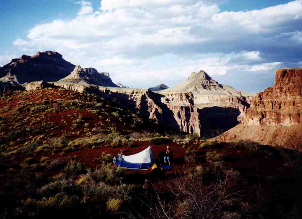
The wind had increased to 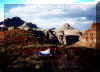 gale-hurricane force again, and we had to wait for an
hour before we could set up the tent. Everything had to be tied down to prevent
it from blowing away. There are many nice gravelly camping areas below Ayer
Point. gale-hurricane force again, and we had to wait for an
hour before we could set up the tent. Everything had to be tied down to prevent
it from blowing away. There are many nice gravelly camping areas below Ayer
Point.
Day 8 (Thursday) we rose early and watched the sunrise. We could see
people at Moran Point with the monocular doing the same. After an oatmeal
breakfast, we packed up and started for the mesa. The trail in this area is
mostly flat, skirting the edge of the Hance Creek canyon. We reached the East Trail to climb the mesa at 10:50 and had an early lunch of Turkey
Tortillas and beef jerky. We saw a group of six hikers on the other side of the
canyon, the first hikers we had seen since Saturday. As we climbed in elevation,
the weather
the East Trail to climb the mesa at 10:50 and had an early lunch of Turkey
Tortillas and beef jerky. We saw a group of six hikers on the other side of the
canyon, the first hikers we had seen since Saturday. As we climbed in elevation,
the weather 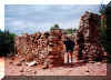 became
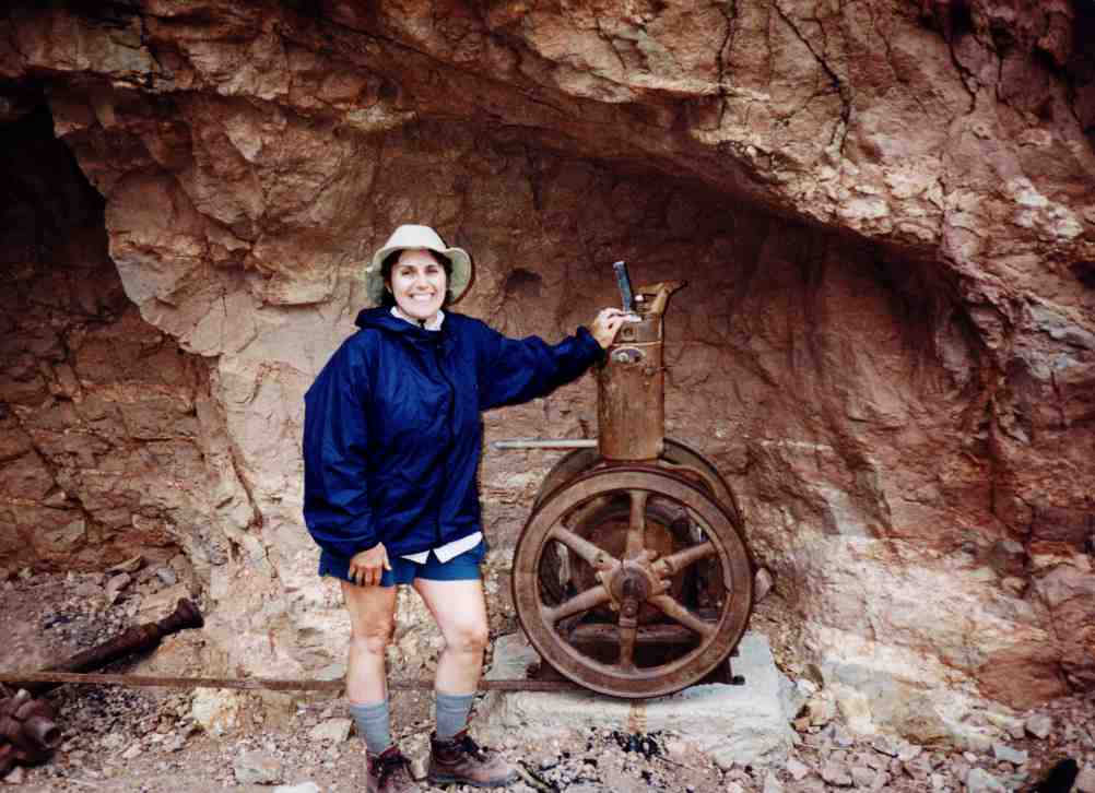
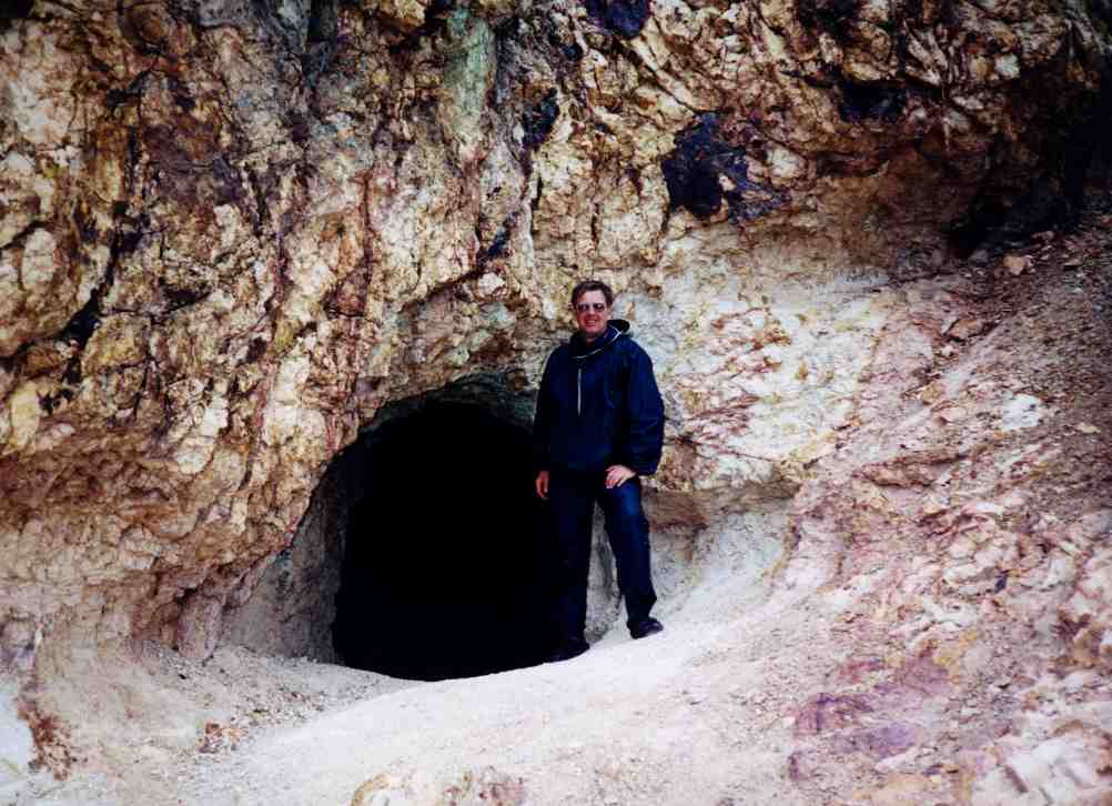
overcast and cool (60F). Almost at the top of the mesa, we happened upon an old
mine and some mining equipment, including an almost intact steam engine to
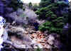
provide power for the mining operation. Reaching the top of horseshoe Mesa, we
saw a second mine, and some brightly colored (blue and green) mineral laden
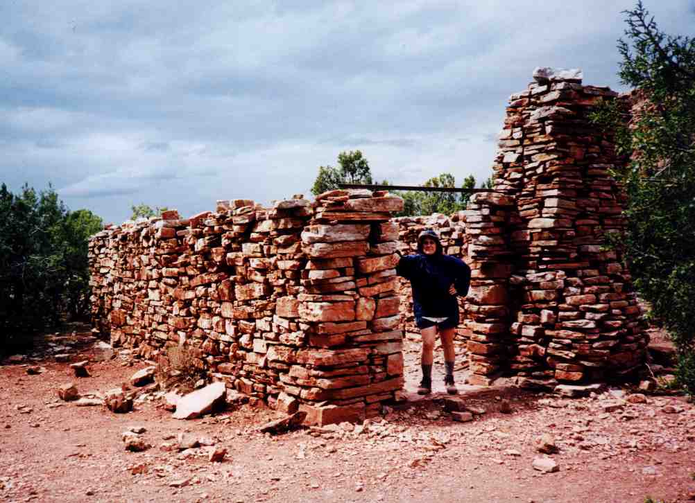
rocks. An old stone structure appeared to be the miners' house, and became
overcast and cool (60F). Almost at the top of the mesa, we happened upon an old
mine and some mining equipment, including an almost intact steam engine to
provide power for the mining operation. Reaching the top of horseshoe Mesa, we
saw a second mine, and some brightly colored (blue and green) mineral laden
rocks. An old stone structure appeared to be the miners' house, and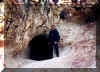 numerous mining artifacts littered the area. The Horseshoe Mesa is a designated
camping area, so we chose one of the allowed sites to set up our camp. There was
only one other camper on
the mesa that evening which we did not even
numerous mining artifacts littered the area. The Horseshoe Mesa is a designated
camping area, so we chose one of the allowed sites to set up our camp. There was
only one other camper on
the mesa that evening which we did not even  realize until the follow morning. It
rained on and off the entire night, the first significant weather on our trip. realize until the follow morning. It
rained on and off the entire night, the first significant weather on our trip.
Day 9 (Friday) started out drizzly, but the weather cooperated and the
rain stopped just in time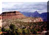 for us to dry out our equipment and break up camp for the hike out. There was
snow at 500 feet below the rim and up. We started up the trail at 9:15. The
lower part of the trail is moderate and relatively easy. There were some long
stretches of switchbacks that almost appeared to have been paved with
cobblestones. We
for us to dry out our equipment and break up camp for the hike out. There was
snow at 500 feet below the rim and up. We started up the trail at 9:15. The
lower part of the trail is moderate and relatively easy. There were some long
stretches of switchbacks that almost appeared to have been paved with
cobblestones. We 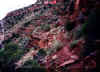 found
them particularly tedious and were glad when we were back on the dirt trail. We
met many day hikers heading down to the mesa, and hoped that they knew what they
were in for. They seemed to have little proper equipment or water to make the
more arduous trip back up to Grandview Point from the mesa. We stopped for a
snack at a saddle with a nice view of the Coronado Butte, and were at the
trailhead at 12:40. After the shock of seeing so many people in one place, we
made our way to the car we had left at Grandview, brushed off the snow, and
headed to Flagstaff for a well deserved mushroom Swiss cheeseburger at Busters. found
them particularly tedious and were glad when we were back on the dirt trail. We
met many day hikers heading down to the mesa, and hoped that they knew what they
were in for. They seemed to have little proper equipment or water to make the
more arduous trip back up to Grandview Point from the mesa. We stopped for a
snack at a saddle with a nice view of the Coronado Butte, and were at the
trailhead at 12:40. After the shock of seeing so many people in one place, we
made our way to the car we had left at Grandview, brushed off the snow, and
headed to Flagstaff for a well deserved mushroom Swiss cheeseburger at Busters.
|